July 1, 1804
[Clark]
July 1st 1804, last night one of the Sentinals Chang'd [challenged] either a man or Beast, which run off, all prepared for action, Set out early passed the Dimond Isd. pass a Small Creek on the L. S. as this Creek is without name we Call it Biscuit Creek [1] Brackfast on the upper point of a Sand beech, The river still falling a little a verry warm Day. I took Some medison last night which has worked me very much party all in helth except Boils— [2]
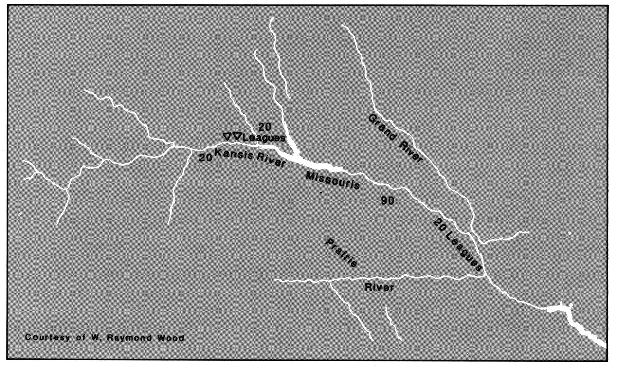
passed a Sand bar in the river above the Isd. Covered for a me. with Drift Wood, Came to Capt Lewis took Medn. altitude & we delayed three hours, the day being excessively hot, Turkeys are plenty on the Shore, 〈Some of the men〉 G. Drewyer inform that he Saw PueCanns [pecan] Trees [3] on S. S. yesterday great quantities of raspburies an Grapes, (2) pass a Creek on the L. S. called remore (Tree Frog) Creek, [4] an Isd above in the Mid: and 〈a Pond on〉 2 Willow Isds on the S. S. all of the Same name; [5] The two Willow Isds. has been made within 3 years & the Main Chanl. runs now on the L S. of the large Island where there was no running wate[r] at low water from this Island the range of Hills up the river to the N, W, pass a run on the L. S. [6] a Butifull extensive Prarie, Two Islands just above Called (Isles des Parques) or Field Islands, [7] those Islands are, one of our French hands tels me that the French intended to Settle here once & brought their Cows and put them on those Islands, Mr Mackey Says the first village of the Kanseis was a little above this Island & made use of as fields, no trace of anything of that Kind remains to be Seen on the Isds. fine Land on the L. Side, Hills near the river all day, Camped on the lower pot. of 1st Isd.— [8]
of Kansas River, ca. July 1, 1804, Field Notes, document 10
| 6 | Mes on the course's of this morning— | |
| N. 32 d W | 1 ½ | ms. to a pt. on the L. Side. |
| N. 14 d W. | to the right Side of an Isd. passed a Creek on L. S. (2) [10] |
|
| N 58 W. | 2 ½ | ms. to pt. L S. passed the head of the Isd. |
| N. 42 W. | 1 ½ | ms. to a pt. on S. S. |
| N. 27 W | ½ | me. to North Side of a Island (3) Creek L. S. and a Butifull extensive [Prarie?] High and dry [11] |
| 13 |
[Clark]
a Small allarm last night all prepared for action, Set out early this morning passed on the North Side of Dimond Island, a Small Creek mouths opposit I call Biscuit Creek,— a large sand bar in the middle of the river 1½ ms. above the Isd. Covered with Drift wood. river fall a little. The wind from S. W. Came to above this Drift and delayed three hours to refresh the men who were verry much over powered with the heat, Great quantity of Grapes & raspberries, (2) passed a Small Creek on the L. S. below one large and two small Islands. This Creek and Isds. are Called Remore (or Tree Frog) a large Pond on the S. S., the main Current of Water run'g on the L. S. of the Island, I am told that Three years ago the main Current run on the S. S. of the Island and no appearance of the two Smaller Islands, Camped on the lower point of one of the two large & 2 Small Isds. Called Isles des Parques or field Islds a high butifull Prarie on the L. S. one of the french hands Says "that the french Kept their Cattle & horses on those Islands at the time they had in this quarter a fort & trading establishment.["]
| N. 62° W. | 1 ½ | ms. on the S. Side of the Isd. |
| N. 40° W | ¼ | me. do do do |
| N. 28° W | ¾ | me. to pt. on L. S. psd. the Isd. |
| N. 45° W | 3 ½ | ms. to a pt. on S. S. psd. Drift |
| N. 32° W | 1 ½ | Me. to a 〈the lower〉 creek 〈pt. of a Isd〉. L.S. |
| N. 58 W | 2 ½ | Ms. to pt. L. S. psd. the head of Isd. |
| N. 42 W. | 1 ½ | ms. to a pt. on 〈L〉 S. S. |
| N. 27 W. | ½ | me. to pt. of Field Isd. prarie L. S. |
| 12 |
paecaun Trees Seen on the S. S. Deer and turkeys in great quantities on the bank
[Lewis]
Sunday July 1st [12]
On the Larboard shore one ½ miles above the upper point of the dimond Island.
Observed Meridian Altd. of ☉'s L. L. with Octant by the back obstn. 36° 59' 30"
Latitude deduced from this obstn. 39° 9' 38.6"
[Ordway]
Sunday July 1st 1804. we Set out at Sun rise passed a Small Creek which we call Bisquet Creek [13] on the South Side of the Missouris, we passed a Sand barr in the river which was covered for a mile with Drift wood, the Day is exceding hot. So we Stoped at 12 oClock & Delayed about 3 hours to rest in the heat of the day, high land on the South Side fine Bottom on the North Side of Missouris, we came to a high prarie on the South Side. we Camped [14] after Comming about 10 or 12 miles, on the North Side of the Missouris. passed Several Islands in course of the Day
[Floyd]
Sunday July 1th 1804 Set out Clear day passed Small Creek on the South Side Called Biscuit C. High Land passed a Creek on the S. Side Called Frog Tree Creek a Pond on the N S. Called the Same name Good water made 12½ miles Campt on an Isd. near the South Side ouer Flanken party Did not Join us Last evning.
[Gass]
Sunday 1st July, 1804. We set out at five in the morning, and having advanced 12 miles, encamped on an island opposite a prairie on the south side of the river.
[Whitehouse]
Sunday July 1st We embarked early this morning, the current set strong against us this day; passed a number of Islands lying on the South side of the River, our Hunters did not come up to us this day. We encamp'd on an Island call'd Green Island, [15] distance that we rowed this day being 12¼ Miles.—

