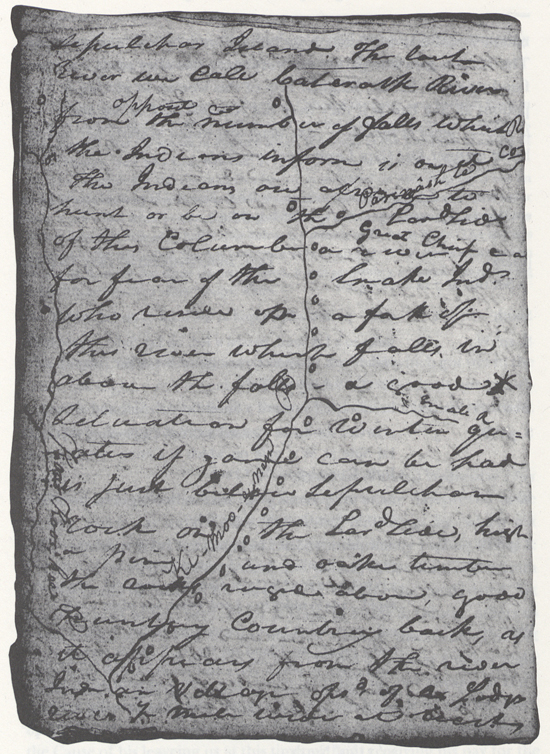
October 10, 1805
[Clark]
Set out at 7 oClock 74.26 [1]
| South | 1 | mile passed a bad rapid at the head of an Isd. on Ld. Side |
| S. 20° W | 1 ½ | miles to a Ld bend, passed a Isd. on Ld. Side. rapid at the Head bad. passed Lower pt. of the other [island] at the mouth of a run on Stard. |
| West | ½ | to a St. bend passed a Small Isd. Ld. Side and a rapid |
| S. 30° W | 3 | mile to a Ld. bend passed a Creek Cg [coming in] on the Ld Side at ½ a mile on which is Cotton wood bottoms Inds. Camp below the Creek |
| West | 2 | miles to the head of an Isd. [2] at bad rapid on both Sides Curt [current] on the right Side |
| S. 30° W. | 4 | mile pd. a rapd at Lower point of Isd & rapid at 1 mile, a rapd at 1½ miles rocky bottoms on each Side a rapid at 2½ miles a run [3] & (Inds. Camp) on Stard Sd at 3 miles a rapid at 3½ miles to a Lard. bend, low plain 100 ft |
| West | 2 | mile to a Stard bend, (passed an Indian bathing in hot bath) rapid an Island on the L. S. Shole waters at the head opsd. to which verry bad rapid we Call raged rapid one Canoe Struck & lodged Sprung a Leak onload Passed Several Inds camps on the Island. Took Meridian altitd. on the Island with Sextent made it 74° 26' Latd 46° 29' 21 7/10" North |
| S W | 1 | mile to a bend on the St. Side psd 2 rapid |
| South | 1 | mile to the L. bend passed 2 rapid a large bottom on each Side |
| S 80 W | 3 | miles to the mouth of a Large fork Caled by the Inds.
Ki- moo-e-nem passed 2 rapids Isd. in mouth |
| West | 1 | mile to a Ld. bend ps Shore in the mouth. Wind high which obliged us to Stop. Kimooenem has two forks on the South Side, & Camps of Inds. all the way up 2d fork called Pâr- nâsh-te about 50 ms. camped on Std. Side to make observt |
| 58 |
a verry worm day, Indians continue all day on the banks to view us as low as the forks. Two Indians come up in a Canoe, who means to accompany us to the Great rapids, Could get no observations, worm night— The water of the South fork is of a bluish green colour
Idaho-Washington border, ca. October 10, 1805
Elkskin-bound Journal
[Clark]
a find Morning loaded and Set out at 7 oClock at 2½ miles passed a run on the Stard. Side [4] haveing passed 2 Islands and two bad rapids at 3 miles lower passed a Creek on the Lard. with wide Cotton willow bottoms haveing passed an Island and a rapid an Indian Camp of three Lodgs below the Creek [5] at 8½ miles lower we arrived at the heade of a verry bad riffle [6] at which place we landed near 8 Lodges of Indians [NB: Choponnesh ] [Ed.: and one word illegible] on the Lard Side to view the riffle, haveing passed two Islands & six rapids Several of them verry bad—after view'g this riffle two Canoes were taken over verry well; the third Stuck on a rock which took us an hour to get her off which was effected without her receving a greater injurey than a Small Split in her Side which was repared in a Short time, we purchased fish & dogs of those people, dined and proceeded on— here we met with an Indian from the falls at which place he Sais he Saw white people, and expressd an inclination to accompany us, we passd. a fiew miles above this riffle 2 Lodges and an Indian batheing in a hot bath made by hot Stones thrown into a pon of water. at this riffle which we Call ragid rapid took meridian altitude of the Suns upper Limb with Sextt. 74° 26' 0" Latd. produced [blank] North at five miles lower and Sixty miles below the forks arived at a large Southerly fork [7] which is the one we were on with the Snake or 〈Sho-Sho-ne〉 So-So-nee nation (haveing passed 5 rapids) This South fork or Lewis's River which has two forks which fall into it on the South the 1st Small the upper large and about 2 days march up imediately parrelal to the first villages we Came to and is called by those Indians Pâr-nash-te [8] on this fork a little above its mouth resides a Chief who as the Indian Say has more horses than he can Count and further Sayeth that Louises River is navagable about 60 miles up with maney rapids at which places the Indians have fishing Camps and Lodjes built of an oblong form with flat ruffs. below the 1st river on the South Side there is ten established fishing places on the 1st fork which fall in on the South Side is one fishing place, between that and the Par nash te River, five fishing places, above two, and one on that river all of the Cho-pun-nish [9] or Pierced Nose Nation many other Indians reside high up those rivers The Countrey about the forks is an open Plain on either Side I can observe at a distance on the lower Stard. Side a high ridge of Thinly timbered Countrey the water of the South fork is a greenish blue, the north as clear as cristial
Imediately in the point is an Indian Cabin & in the South fork a Small Island, we came to on the Stard. Side below with a view to make some luner observations [10] the night proved Cloudy and we were disapointed— The Indians Came down all the Couses of this river on each Side on horses to view us as we were desending,— The man whome we saw at the ruged rapid and expressed an inclination to accompany us to the great rapids, came up with his Son in a Small Canoe and procisted in his intentions— worthey of remark that not one Stick of timber on the river near the frks and but a fiew trees for a great distance up the River we decended I think Lewis's [11] River is about 250 yards wide, the Koos koos ke River about 150 yards wide and the river below the forks about 300 yards wide. a miss understanding took place between Shabono one of our interpreters, and Jo. & R Fields which appears to have originated in just— [12] our diet extremely bad haveing nothing but roots and dried fish to eate, all the Party have greatly the advantage of me, in as much as they all relish the flesh of the dogs, Several of which we purchased of the nativs for to add to our Store of fish and roots &c. &c.—
| October 7th | ||
| N. 80° W. | 1 | mile to a Starboard Bend passed a rapid opsd. a Stony point on Lard. |
| S. W— | 1 ½ | to a Lard. bend high hills Steep |
| West— | ½ | to the Stard. Side passed a rapid |
| S W.— | 1 | to a Lard. bend. high Steep hills |
| N. 70° W. | 1 ½ | to a Stard. Bend passed a rapid |
| S. 60° W. | 1 ½ | to a Lard. Bend passed a bad rapid |
| West ☞ |
3 | to a Stard. Bend passed a rapid at ½ a mile, a creek on the Lard. Side at 2 miles. |
| S. 10° E. | 1 ½ | to a Lard. bend passed a rapid |
| N. 60° E | 1 ½ | to a Stard. bend passed a rapid. |
| South | 1 | to a Lard. bend passed a bar rapid |
| West | 1 | in the Lard. bend, Cliffs high and rugid |
| N. W. | ½ | to a bad rapid in Lard bend. |
| S. 70° W. | 1 ½ | to a Starboard bend open Country, |
| S. W. ☞ |
2 | to a Lard. bend at the mouth of a run opsd. to which 2 Lead Canisters were buried. |
| October 8th | ||
| N. W. | 1 | to a rapid in the Stard. Bend |
| South | ¼ | through a very bad rapid |
| S. 70° W | ½ | to a Lard. Bend, through good water |
| N. W.— | ¼ | through a rapid in the Stard. Bend |
| West | 2 ½ | to a Stard. Bend passed a bad rapid at one, and one at two miles |
| South | 1 ½ | to a Lard. Bend opsd. a Stoney bottom |
| S. 70° W. | 2 ½ | to a Stard. Bend, passed an Island on the Lard. Side, a rapid at the upper and lower point of the Island on the Lard. Side. Several Lodges on Island & on the 〈Stard Shore〉 |
| S. W. | 2 | to a Stard. bend passed a rapid below which we 〈pass〉 halted at 3 Lodges, passed lower point at The Island Std. side |
| West ☞ |
2 ½ | miles passed an Island on which three lodges of Indians were Encamped opposit a Small Creek on the Lard. Side and on the Std. Side below Six other Lodges, psd. two rapids opsd. the Island. |
| S. W | 1 ½ | to a Stard. bend passed a rapid |
| S. 40° E | 1 ½ | to a Lard Bend passed a rapid |
| S. 60° W. | 2 | to a Stard. Bend passed an Island on the Lard. Side and a bad rapid |
| S. W.— ☞ |
1 ½ | to a Stard. Bend passed an Island on the Lard. Side a rapid at the upper and lower point, a large Creek Colter Creek falls in on the Std. Side above the low rapid. Canoe Sunk here |
| West | 1 ½ | to the upper point of an Island on the Stard. Side bad rapid Lard. |
| October 10th | ||
| South | 1 | mile passed a bad rapid at the head of an Island on the Lard Side |
| S. 20° W. ☞ |
1 ½ | to a Lard Bend passed an Island on the Lard. Side, a bad rapid at the upper point, passed the Lower point of a Sec- ond Island opsd. the mouth of a run on the Stard. Side |
| West | ½ | to a Stard. Bend passed a Small Island on the Lard. Side a rapid |
| S. 30° W. ☞ |
3 | to a Lard. Bend passed a Creek on the Lard. Side at ½ a mile Some Cotton wood in its bottom & 3 Lodges |
| West | 2 | to the head of an Island at a bad rapid on both Sides, Cur- rent on the right Side & |
| S. 30° W. | 4 | to a Lard. Bend passed a rapid at the lower point of the Island, passed rapids at one 1½, 2½ & 3½ miles, a branch and Indian Camp at three miles |
| 52 | ||
| West | 3 | miles to a Stard. bend passed a bad ragid rapid (one Canoe Stuck) above which we passed two large Indian Encampments. |
| S. W. | 1 | to a Starbd. bend passed a rapid |
| South | 1 | to a Lard Bend passed two rapids a bottom on either Side |
| S. 80° W. | 3 | to the mouth of
Louises River
[14] on the Lard. Side, passed two rapids—. about 250 yards wide |
| miles | 60 |
The Cho-pun-nish [15] or Pierced nose Indians are Stout likeley men, handsom women, and verry dressey in their way, the dress of the men are a white Buffalow robe or Elk Skin dressed with Beeds which are generally white, Sea Shells—i e the Mother of Pirl hung to ther hair & on a pice of otter Skin about their necks hair Cewed in two parsels hanging forward over their Sholders, feathers, and different Coloured Paints which they find in their Countrey Generally white, Green & light Blue. Some fiew were a Shirt of Dressed Skins and long legins, & Mockersons Painted, which appears to be their winters dress, with a plat of twisted grass about their necks. [16]
The women dress in a Shirt of Ibex, or 〈Goat〉 [X: Argalea] Skins which reach quite down to their anckles with 〈out〉 a girdle, their heads heads are not ornemented, their Shirts are ornemented with quilled Brass, Small peces of Brass Cut into different forms, Beeds, Shells & curios bones &c. The men expose those parts which are generally kept from few [X: view] by other nations but the women are more perticular than any other nation which I have passed in Screting the parts
Their amusements appear but fiew as their Situation requires the utmost exertion to prcure food they are generally employed in that pursute, all the Summer & fall fishing for the Salmon, the winter hunting the deer on Snow Shoes in the plains and takeing care of ther emence numbers of horses, & in the Spring cross the mountains to the Missouri to get Buffalow robes and meet &c. at which 〈it〉 time they frequent meet with their enemies & lose their horses & maney of ther people
Ther disorders are but fiew and those fiew of a Scofelous nature. [17] they make great use of Swetting. The hot and cold baethes, They are verry Selfish and Stingey of what they have to eate or ware, and they expect in return Something for everything give as presents or the Survices which they doe let it be however Small, and fail to make those returns on their part. [18]
[Ordway]
Thursday 10th Oct. 1805. a clear morning. the two guides [19] who came with us from the Snake nation left us yesterday, and we expect they have returned back again. we Set out eairly and proceed on down passed over a number of bad rapids took water in the canoes by the waves. passd Several Camps of Indians where they had large fisherys we bought Some from them. they have pleanty of Small canoes for the purpose of fishing. about 11 oClock we came to a verry bad rapid which was full of rocks, we halted and took one canoe down at a time one of them Struck a rock in the rapid and broke a hole in hir Side but with Some difficulty we got hir Safe to Shore unloaded & repaired hur. the Indians caught some of the oars &c for us. we bought a little more Sammon and one or two dogs, and about 2 oC. we Set out again and proceeded on as usal. passed Several Sholes where we had to wade and hale the canoes over passd several more fishing camps. about 5 oClock P. M. we came to the Columbia River [20] which is wide and deep. we went on down it a short distance and the wind blew so high from N W that we had come 20 miles to day and nearly a west course. this great columbia River is about 400 yards wide and afords a large body of water and of a greenish coulour. the country on each Side is high barron and mostly broken Some high plains which look pleasant, but no wood only a fiew willows in Some places along the Shores.—
[Gass]
Thursday 10th. We had a fine morning; embarked early, and passed over some very bad rapids. In passing over one a canoe sprung a leak, but did not sink; though the greater part of the loading was wet; and we had to halt and dry it. We stopped a short distance above the junction of this with another large river. The natives call this eastern branch Koos-koos-ke, and the western Ki-mo-ee-nem. [21] Yesterday evening I had a fit of the ague, and have been very unwell to day; so much so that I am unable to steer my canoe. In about 2 hours we continued our voyage again; we found the southwest branch very large, and of a goslin-green colour. About a mile below the confluence we halted on the north side and encamped [22] for the night, as the wind blew so hard we could not proceed. We came 20 miles to day.
[Whitehouse]
Thursday 10th Oct. 1805. a fair morning. our 2 Indians who came with us from the Snake nation left us yesterday. we Set out eairly and proceeded on down Several bad rapids took in Some water in the canoes. passed Several Indian fishing Camps where we bought Some Sammon from them they have a nomber of Small canoes along the Shore. about 11 oClock we came to a verry bad rockey rapid, where we halted and took one canoe over at a time. one of the canoes ran fast on a rock Stove a hole in hir Side with Some difficulty we got hir to Shore, unloaded and repaired hir Some of the natives caught Some of our oars and poles which was washed away in the rapids. we bought some more Sammon, & a dog or two. about 2 oClock we proceeded on passed Several more fishing Camps. passed down Some verry bad rapids which were Shallow. we had to wade in Several rapids to hale the canoes over. about 5 oClock P. m. we arived at the forks of the Columbian river. we proceeded on down it a Short distance and the wind blew So high from the west that we Camped on the Starbord Side. had come 20 miles this day & mostly a west course a nomber of fishing camps along the Shores about the forks. this is a large River afords a large body of water & is about 400 yards wide, and of a greenish coulour. No timber barron & broken praries on each Side.—
Thursday October 10th A pleasant morning, the two Indians that accompanied us from the Snake Nation of Indians left us, in order to return home, We set out early & proceeded on down the River & passed over some bad rapids where our Canoes took in Water, We passed several Indian fishing Camps where the Natives were fishing. We halted at them a short time; & purchased some Salmon from them.— Those Indians had a number of small Canoes lying along the shore. About 11 o'Clock A. M. we came to a very bad rockey rapid, where we halted, & took one Canoe over at a time. One of our Canoes run fast on a Rock, & 〈stove〉 broke a hole in her side, & it was with much difficulty, we got her to the shore, where we unloaded and repaired her, Some Natives that were below where this accident happened caught the Oars & poles belonging to our Canoes, which we lost in the Rapids as we came along, They brought them to us, & we purchased from them some Salmon & 2 dogs for Provisions.— About 2 o'Clock P. M. we proceeded on, & passed several more fishing Camps & down some very bad Rapids, which were shallow, We had to waid in the Water at several of those Rapids in Order to hawl our Canoes over them. At 5 o'Clock P. M. we arrived at another of the forks of Columbia River & proceeded on down it a short distance. The Wind blowing so hard from the Westward that we were obliged to come too, & We encamped on the North side of the River. We came 20 Miles this day, & our Course has been nearly West.— the whole of the way.—
We found along shore near the forks of Columbia River, a number of fishing camps, The River now became large & contained a large body of Water which appears of a Greenish Colour & it is about 400 Yards wide & has no Timber along its shores & the land on both sides of the River is barren & broken Priaries.—

