Images & Maps
Note: These images are courtesy of the American Philosophical Society library. Permission to reproduce is required.
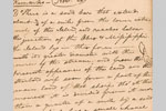 Sand Bar, November 20, 1803, Eastern Journal
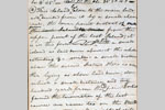 Island, November 20, 1803, Eastern Journal
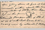 Island, November 21, 1803, Eastern Journal
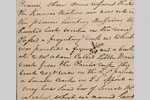 Manitou on a Rock, June 5, 1804, Codex A, p. 34
 Mississippi River and Tributaries in Present Minnesota, undated (winter 1804–5), Codex C, p. 155
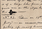 Large "convolvalist" leaf (Convolvulus sepium L., hedge bindweed), July 17, 1804, Codex R, p. 37
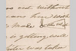 War Hatchet, January 28, 1805, Codex C, p. 158
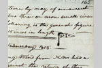 Battle Ax, February 5, 1805, Codex C, p. 165
 Falls and Portage of the Missouri River, ca. July 4, 1805, Codex E, pp. 132–33
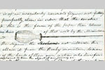 Shoshone Smoking-pipe, August 13, 1805, Codex F, p. 99
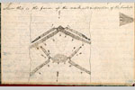 Shoshone Fish Weir, August 21, 1805, Codex F, p. 147
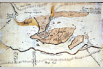 Great (Celilo) Falls of the Columbia River, Washington and Oregon, October 22–23, 1805, Codex H, p.1
 Long and Short Narrows (The Dalles) of the Columbia River, Washington and Oregon, October 22–28, 1805, Codex H, pp. 2–3
 Shape of a Hut Door, October 24, 1805, Codex H, p. 63
 Great Rapids (Cascades) of the Columbia River, Washington and Oregon, October 30–November 2, 1805, Codex H, p. 4
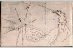 Mouth of the Columbia River, Washington and Oregon, ca. November 16–25, 1805, Codex I, p. 152
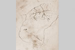 Point Adams, Oregon, ca. December 1, 1805, Codex Ia, p.7
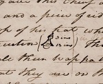 Conic Hat, December 29, 1805, Codex I, p. 80
 Tongue Point, Oregon, Winter 1805–6, Codex I, p. 11
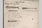 Two Swords, a Bludgeon, and a Paddle, January 1, 1806, Codex J, p. 1
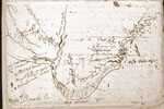 Route to the Whale Site, ca. January 6–10, 1806, Clark's First Draft
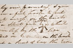 Skate (big skate, Raja binoculata), January 7, 1806, Clark's First Draft
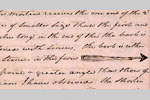 Arrow, January 15, 1806, Codex I, p. 119
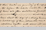 Bone Fishhook and Line, January 16, 1806, Codex J, p. 28
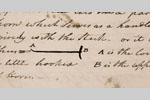 Digging Instrument, January 23, 1806, Codex I, p. 135
 Digging Instrument, January 24, 1806, Codex J, p. 40
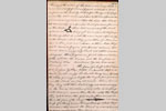 Conic Hat and Double-edged Knife, January 29, 1806, Codex I, p. 144
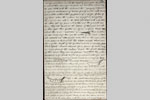 Paddle, Small Canoe, Canoe with High Bow, and Most Common Canoe, February 1, 1806, Codex J, p. 52
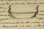 Canoe with Carved Images, February 1, 1806, Codex J, p. 53
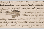 Fir Leaf (Douglas fir, Pseudotsuga taxifolia), February 9, 1806, Codex J, p. 65
 Maple Leaf (vine maple, Acer circinatum), February 10, 1806, Codex J, p. 66
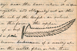 Fern Leaf (Christmas fern, Polystichum munitum), February 13, 1806, Codex J, p. 71
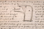 Head of a Vulture (California condor, Gymnogyps califorianus), February 17, 1806, Codex J, p. 80
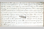 Pine Cone (Sitka spruce, Picea sitchensis), February 18, 1806, Codex J, p. 83
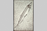 Eulachon (Thaleichthys pacificus), February 24, 1806, Codex J, pp. 93
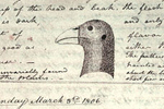 Head of Cock of the Plains (sage grouse, Centrocercus urophasianus), March 2, 1806, Codex J, p. 107
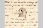 Head of a White Gull (northern fulmar, Fulmarus glacialis), March 7, 1806, Codex J, p. 115
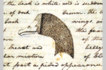 Head of a Brant (greater white-fronted goose, Anser albifrons), March 15, 1806, Codex J, p. 131
 White Salmon Trout (coho salmon, Oncorhynchus kisutch), March 16, 1806, Codex J, p. 133
 Iron Scimitar, March 29, 1806, Codex K, p. 14
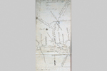 Confluence of Willamette and Columbia Rivers and Environs, April 3, 1806, Codex K, pp. 28–29
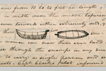 Two Views of a Canoe, April 6, 1806, Codex K, p. 33
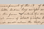 Bone Fishhook, April 26, 1806, Codex K, p. 83
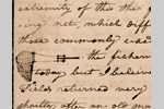 Fish Net, May 18, 1806, Codex K, p. 139
 Snake and Missouri Rivers and their Connections, May 29–31, 1806, Codex M,pp. 1–2
 Lewis's Route from Traveler's Rest to the Missouri River, ca. July 3–11, 1806, Codex N, pp. 149–50
Note: These images are courtesy of the Missouri Historical Society library. Permission to reproduce is required.
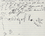 Area about Fort Mandan and North to the Assinboine River, undated (winter 1804–05), Voorhis Collection, Missouri Historical Society
 Aspect of the Missouri River, April 28, 1805, Voorhis no. 1
 Ibex (bighorn sheep, Ovis canadensis), May 25, 1805, Voorhis no. 1
 Falls and Portage of the Missouri River, ca. July 2, 1805, Voorhis no. 1
 Great Falls of the Missouri River, ca. July 3, 1805, Voorhis no. 1
 "Handsome Falls" (present Rainbow Falls) of the Missouri River, ca. July 3, 1805, Voorhis no. 1
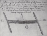 "Upper Falls" (present Black Eagle Falls) of the Missouri River, ca. July 3, 1805, Voorhis no. 1
 Route from Traveler's Rest toward Lolo Trail, Montana, September 11–12, 1805, Elkskin-bound Journal
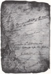 On the Lolo Trail, Idaho, September 13–16, 1805, Elkskin-bound Journal
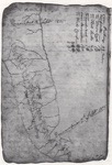 On the Lolo Trail, Idaho, September 16–18, 1805, Elkskin-bound Journal
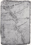 On the Lolo Trail, Idaho, September 18–20, 1805, Elkskin-bound Journal
 On the Lolo Trail to Canoe camp at the Junction of the North Fork Clearwater and Clearwater Rivers, Idaho, September 20–October 7, 1805, Elkskin-bound Journal
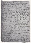 Confluence of the Clearwater and Snake Rivers, Idaho-Washington Border, ca. October 10, 1805, Elkskin-bound Juornal
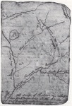 Columbia River and Affluents, Washington, ca. October 13, 1805, Elkskin-bound Journal
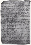 Indian Locales on Columbia River and Affluents, ca. October 14, 1805, Elkskin-bound Journal
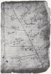 Indian Groups of the Columbia River Basin, ca. October 15, 1805, Elkskin-bound Journal
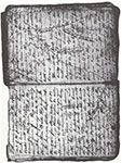 Indian Groups on Columbia River and Affluents, ca. October 18, 1805, Elkskin-bound Journal
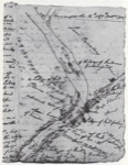 Columbia River near Mouth of Walla Walla River, Washington, October 16–18, 1805, Elkskin-bound Journal
 Confluence of Snake and Columbia Rivers, Washington, ca. October 18, 1805, Voorhis No. 4
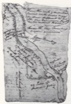 Columbia River near Mouth of Umatilla River (not shown), Washington and Oregon, ca. October 19, 1805, Elkskin-bound Journal
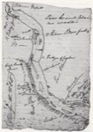 Columbia River, Area between Mouths of Umatillaand John Day Rivers (not shown), Washington and Oregon, ca. October 20, 1805, Elkskin-bound Journal
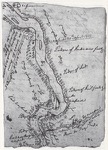 Columbia River near Mouth of John Day River, Washington and Oregon, ca. October 20, 1805, Elkskin-bound Journal
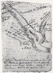 Columbia River near Mouth Deschutes River, Washington and Oregon, ca. October 21, 1805, Elkskin-bound Journal
 Great (Celilo) Falls of the Columbia River, Washington and Oregon, October 22–23, 1805, Voorhis No. 4
 Long and Short Narrows (The Dalles) of the Columbia River, Washington and Oregon, October 22–28, 1805, Voorhis No. 4
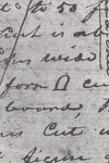 Shape of a Hut Door, November 1, 1805, Elkskin-bound Journal
 Great Rapids (Cascades) of the Columbia River, Washington and Oregon, October 30–November 2, 1805, Voohis No. 4
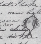 Flounder (starry flounder, Platichthys stellatus), November 18, 1805, Elkskin-bound Journal
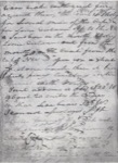 Area about Cape Disappointment, ca. November 18, 1805, Elkskin-bound Journal
 Plan of Fort Clatsop Drawn over Area of Youngs Bay, ca. December 7, 1805, Elkskin-bound Journal
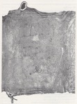 Plan of Fort Clatsop, ca. December 7, 1805, Elkskin-bound Journal
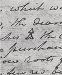 Conic Hat, December 29, 1805, Elkskin-bound Journal
 Method of Head-flattening and Adults with Skull Deformation, ca. January 30, 1806, Voorhis No. 2
 Paddle, Small Canoe, and Sharp-pointed Paddle, February 1, 1806, Voorhis No. 2
 Another Small Canoe, Canoe with High Bow, and Most Common Canoe, February 1, 1806, Voorhis No. 2
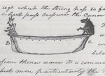 Canoe with Carved Images, February 1, 1806, No. 2
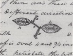 Stalk and Leaves of the Shallon (salal, Gaultheria shallon), February 8, 1806, Voorhis No. 2
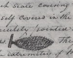 Fir Cone (Sitka spruce, Picea sitchensis), February 9, 1806, Voorhis No. 2
 Maple Leaf (vine maple, Acer Circinatum), February 10, 1806, Voorhis No. 2
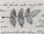 Evergreen Shrub Leaf (Oregon grape, Berberis aquifolium), February 12, 1806, Voorhis No. 2
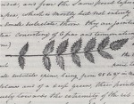 Evergreen Shrub Leaf (dull Oregon grape, Berberis nervosa), February 12, 1806, Voorhis No. 2
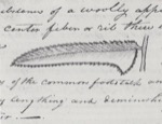 Evergreen Shrub Leaf (dull Oregon grape, Fern Leaf (Christmas fern, Polystichum munitum), February 13, 1806, Voorhis No. 2
 Head of a Vulture (California condor, Gymnogyps californianus), February 16, 1806, Voorhis No. 2.
 Eulachon (Thaleichthys pacificus), February 25, 1806, Voorhis No. 2
 Cock of the Plains (sage grouse, Centrocercus urophasianus), March 2, 1806, Voorhis No. 2
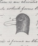 Head of a White Gull (northern fulmar, Fulmarus glacialis), March 6, 1806, Voorhis No. 2
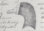 Head of a Brant (greater white-fronted goose, Anser albifrons), March 15, 1806, Voorhis No. 2
 White Salmon Trout (coho salmon, Oncorhynchus kisutch), March 16, 1806, Voorhis No. 2
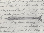 Iron Scimitar, March 30, 1806, Voorhis No. 2
 Plan of Chinookan House, April 3, 1806, Voorhis No. 2
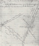 Confluence of Willamette and Columbian Rivers and Environs, April 3, 1806, Voorhis No. 2
 Columbian, Missouri, and Yellowstone Rivers and their Connections, ca. April 4, 1806, Voorhis No. 3
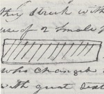 Game Bone, April 18, 1806, First Draft Voorhis Fragment
 Confluence of Snake and Columbia Rivers and Environs, ca. April 18-20, 1806,Voorhis No. 3
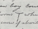 Bone Fishhook, April 26, 1806, Voorhis No. 3
 Fish Weir, April 29, 1806, Voorhis No. 3
 Fish Net, May 11, 1806, Voorhis No. 3
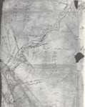 Yellowstone River, Sweetgrass-Stillwater Counties, Montana, July 17–18, 1806, Vorhis First Draft
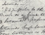 Islands on the Yellowstone River, Stillwater County, Montana, July 18, 1806, Voorhis First Draft
Note: These images are courtesy of the Beinecke Library, Yale University. Permission to reproduce is required.
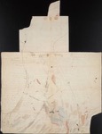 Confluence of Ohio and Mississippi Rivers, ca. November 15, 1803, Field Notes, document 3
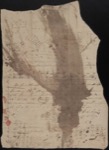 Plan of Camp Dubois, ca. December 29, 1803, Field Notes, reverse of document 1
 Confluence of Missouri and Mississippi Rivers, ca. January 3, 1804, Field Notes, reverse of document 4
 Sketches of the Keelboat, ca. January 21, 1804, Field Notes, reverse of document 7
 Sketch of the White Pirogue, ca. April 12, 1804, Field Notes, reverse of document 10
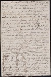 Missouri River near Mouth of Osage River and East, ca. June 1, 1804, Field Notes, reverse of document 17
 Manitou on a Rock, June 5, 1804, Codex A, p. 34
 Manitou, Buffalo, and Indian on a Rock, June 7, 1804, Field Notes, reverse of document 19
 Missouri River near Mouth of Osage River and West, ca. June 13, 1804, Field Notes, reverse of document 18
 Missouri River near Mouth of Grand River to Beyond Mouth of Kansas River, ca. July 1, 1804, Field Notes, document 10
 Profile of a Boy, August 12, 1804, Field Notes, document 42
 Sketch of a Horse, August 19, 1804, Field notes, document 43
 Bon Homme Island on the Missouri River, ca. September 2, 1804, Field Notes, document 51
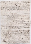 Missouri River near present Fort Randall Dam, South Dakota, ca. September 9, 1804, Field Notes, reverse of document 53
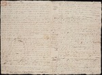 Big Bend of the Missouri River, ca. September 21, 1804, Field Notes, document 56
 Country between the Missouri and Red Rivers, ca. December 17, 1804, Field Notes, reverse of document of 66
 Profile of a Man with Pipe, ca. March 29, 1805, Field Notes, reverse of document 64


