June 5, 1804
[Clark]
June 5th Tuesday, Jurked the Vennison Killed yesterday, [1] after Seting over the Scouting Party or hunder of 3 men Set out at 6 oClock Course N 57° W to a pt. on S. Sd. 5 ms. passed a Creek on L. Sd. I call Lead C [2] of 15 yds passed one on the S. Called Lit: good-womans Creek [3] about 20 yds. wide Passed a Willow Isd. a Butifull Prarie approaching near the river above Lead C & extends to the Mine river [4] in a westerly Derection, passed the Mouth of the Creek of the Big Rock [5] 15 yds Wide at 4 ms. on the Lbd Sd. at 11 oClock brought a Caissie [cajeu] in which was 2 men, from 80 League up the Kansias River, where they wintered and caught a great qty of Beever but unfortunattey lost it by the burning of the plains, the Kansas Nation [6] hunted on the Missourie last Winter and are now persueing the Buffalow in the Plains, passed a Projecting Rock called the Manitou a Painting [7] from this Deavel to the Pt. on the Lbd Side N 23° W 7½ Ms. The Same course 2 ½ ms. Creek Cld. Manitou [8] passed a 〈large Isd.〉 on the Lbd. Side about 40 yd. wide, a Sand bar in the middle of the River passed up between the Sand & L. Shore one Mile to a Small Creek 10 yd. wide, (I call Sand C). [9] We run on the Sand and was obliged to return to the Starbd Side, I am verry unwell with a Slight feever from a bad cold caught three days ago at the Grand' so' [Osage?] R— passed a Small Willow Isd. on S. Side, a large one in the Middle of the river, [10] York Swam to the Isd. to pick greens, and Swam back with his greens, the Boat Drew too much water to cross the quick Sands which intervened, She draws 4 foot water, a fair wind our mast being broke by accidence provented our takeing the advantage of it passed the lower point of a large Island, opposit the Current devides between 〈three〉 4 Small Isds on the St Side. we found the water excessively hard for 12 Miles as we were oblged to pass up the center of the Current between two of the Isds. & round the heads of the other 2 the Current Setting imediately against the points which was choked up with Drift for a mile— Above those Isd. on the St. Side we camped altogeth[er] [11] our Hunter or Spis [spies] [12] discovered the sign of a war party of abt. 10 Men [13]
[Clark]
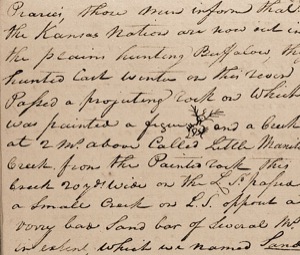
after Jurking the meet Killed yesterday and Crossing the hunting party we Set out at 6 oClock, from the last Course & distance, N 51° W. 5 ms. to a pt. on the St: Sd. passed a Small Creek on the Ld. S: I call Lead C. passed a Creek on the S. S. of 20 yds. wide Cald. Lit: [NB: Little] Good Womans C. on the L. S. a Prarie extends from Lead C. parrelel with the river to Mine river, at 4 ms. Passed the Creek of the big rock about 15 yds. wide on the L. Sd. at 11 oClock brought too a Small Caissee [NB: raft made of two canoes tied together] in which was two french men, from 80 Leagues up the Kansias [NB: Kanzas] R. where they wintered, and Cought a great quantity of Beaver, the greater part of which they lost by fire from the Praries, those men inform that the Kansas Nation are now out in the plains hunting Buffalow, they hunted last winter on this river Passed a projecting rock on which was painted a figue [14] and a Creek at 2 ms. above Called Little Manitou Creek from the Painted rock this Creek 20 yds. wide on the L. Sd. passed a Small Creek on L. S. opposit a Verry bad Sand bar of Several ms. in extent, which we named Sand C here my Servent York Swam to the Sand bar to geather greens for our Dinner and returnd with a Sufficent quantity wild Creases [NB: Cresses] or Teng [NB: Tongue] grass, [15] we passed up for 2 ms on the L. S. of this Sand and was obliged to return, the Watr. uncertain the quick Sand Moveing we had a fine wind, but could not make use of it, our Mast being broke, we passed between 2 Small Islands in the Middle of the Current, & round the head of three a rapid Current for one mile and Camped on the S. S. opsd. a large Island in the middle of the river; one Perogue did not get up for two hours, our Scout discovd. the fresh sign of about 10 Inds. I expect that those Indians are on their way to war against the Osages nation probably they are the Saukees
| N. 51° W. | 5 | ms. to a pt. on S. S: psd. 3 C. 1 S. 2 L. S. |
| N. 23° W | 7 ½ | ms. a pt. L S. psd. Mont. Creek |
| 12 ½ |
[Ordway]
Tuesday June 5th 1804. a fair 〈day〉 passed Lead Creek on South Side of the River & Little Good woman Creek on the N. Side, came 9 miles. passed the Creek of the Big Rock 15 yds. wide, at a 11 oClock we met 2 Frenchmen in 2 canoes locked together Loaded with Peltry &C. they came from 80 Leagues up the Kansias River, [16] where they wintered, then we passed a high Clifts of Rocks on which was painted the pickture of the Devil on South Side of the River. we Encamped on the N. Side of the River at the upper point of an Island. the land is Rich well watered &.C. the hunters killed 2 Deer this day—
[Floyd]
Tusday June 5th fair day pased Lead Creek on South Side of the River— Littel Good woman Creek on the N. Side Came 9 miles past the Creek of the Big Rock 15 yads wide at a 11 〈mil〉 oClock we met 2 French in 2 conoes lashed together Loaded with peltry &c. they Came from 80 Leages up the Kensier River whare they wintered water Strong past Severall Isd. Came 15 miles encamped on the N. Side at the uper pint of Isd. the land is Good well timberd well waterd ouer hunters Kild one Deer
[Gass]
Tuesday 5th. We passed Mine creek [17] on the south side, and Little Goodwoman creek on the north: also the creek of the Big Rock. We met two Frenchmen in two canoes laden with peltry; passed a high cliff of rocks on the south side, and encamped on the north side. The land about this place is good and well timbered.
[Whitehouse]
Tuesday 5th June 1804. [18] a fair morning. we Set out eairly and proceeded on passed a creek on the South Side and Camped on the Same Side.—
Tuesday June 5th We embarked early this Morning & proceeded on our Voyage, and passed a Creek lying on the South side of the River, the name unknown, in the evening we encamped on the same side of the River, our course being still West by South
Joseph Whitehouse
much no much
434
860
1665
[8? net. wt.?]
9
[Joseph Whitehouse?]
On the next page are the words "Joseph Whitehouse" and a number of other writings, mostly illegible. (back)


