November 18, 1805
[Clark]
a little Cloudy this morning I set out at day light with 10 men & my Sevent, Shabono, Sergt. Pryer odderway Jos. & R. Fields Shannon Colter, wiser, Lebiech & york proceeded on Down the Shore from the 1st point [1]
| N. W | 6 | miles to a lodge at the enterance of a river [2] on the Std. in the middle of a boggey Bay |
| S. 79° W. | 7 | miles to the mouth of a River old Cabins open bogs above for 2 ms. back we Call after the nation Chin-nook River [3] from this river to Camp Point is |
| S. 64° E | to Bluff Point (a small Island in a nitch of the Bay in the Same Course) is |
|
| S. 20° W. | 1 ½ | miles psd. a to
Cape Disapt.
is South— To point adams
is S. 22° E—About 25 miles— passed a part of a fish about 1 mile above I supposed to be a Grampass— [4] The men killed 4 brants & 〈we〉 Lab. Killed 48 pliver of 2 different kinds yellow & black legs— I had them picked cooked and we Dined on them. |
| S. 80° W. | 1 | mile to the bottom of a nitch at a branch from a pond |
| South 8° W. | to an Isd. in the 2d nitch from this passed 2 points in the Course To the center of the 1s Nitch a run is 1 mile To the do. of th 2 do is 1 mile |
November 18, 1805, Elkskin-bound Journal
At a run & Island near the Shore here the Traders ancher & trade. [5] we passed at each point a Soft Clifts of yellow, brown & dark Soft Stones [6] here Capt Lewis myself & Severl. of the man marked our names day of the month & by Land &c. &c. from this S. W. 3 miles to the Iner pt. of Cape Disapointmt passed a point & 2 Small nitches (Reuben Fields killed a Vulter) [7] we found a Curious flat fish Shaped like a turtle, with fins on each side, and a tale notched like a fish, the Internals on one Sid and tale & fins flat wise This fish Flownder [8] has a white 〈belly〉 on one Side & lies flat to the Ground— passed from last nitch across to the ocean ½ a mile low land the Cape is a high Partly bald hill, founded on rock, I assended a high Seperate bald hill [9] Covered with long corse grass & Seperated from the hight of Country by a Slashey bottom 2 miles S. 60 W of the Cape— thence to a 2d Grassey pt is N. 50° W. 2 miles, Those hills are founded on rocks & the waves brake with great fury against them, the Coast is Sholey for Several miles of this Cape & for Some distance off to the N W a Sand bar in the mouth. Sholey Some distance out from the mouth The Coast from the Cape N W is open for a Short distance back then it becomes thick piney Countrey intersperced with ponds
ca. November 18, 1805, Elkskin-bound Journal
Point addams is 〈S. W〉 S 20° W about 20 miles the Course on that Side bears S 45 W. I cannot assertain the prosise Course of the Deep water in the mouth of the river, the Channel is but narrow. I proceeded on up above the 2d point and Encamped on the Shore above the high tide, [10] evening Clear, for a Short time. Supd. on Brant and pounded fish men all Chearfull, express a Desire to winter near the falls this winter.—
[Clark]
A little cloudy this morning I Set out with 10 men and my man York to the Ocian by land. i. e. Serjt. Ordway & Pryor, Jos. & Ru. Fields, Go. Shannon, W. Brattin, J. Colter, P. Wiser, W. Labieche & P. Shabono one of our interpreters & York. I Set out at Day light and proceeded on a Sandy beech
| N. 80° W. | 1 | Mile to a point of rocks about 40 feet high, from the top of which the hill Side is open and assend with a Steep assent to the tops of the Mountains, a Deep nitch and two Small Streams above this point, then my course was |
| N. W. | 7 | Mile to the enterance of a creek at a lodge or cabin of Chin- nooks passing on a wide Sand bar the bay to my left and Sev- eral Small ponds Containing great numbers of water fowls to my right; with a narrow bottom of alder & Small balsam between the Ponds and the Mountn. at the Cabin I saw 4 womin and Some Children one of the women in a desper- ate Situation, covered with Sores Scabs & ulsers no doubt the effects of veneral disorder which Several of this nation which I have Seen appears to have. This Creek appears to be nothing more than the conveyance of Several Small dreans from the high hills and the ponds on each Side near its mouth. here we were Set across all in one Canoe by 2 Squars to each I gav a Small hook |
| S. 79° W. | 5 | Miles to the mouth of
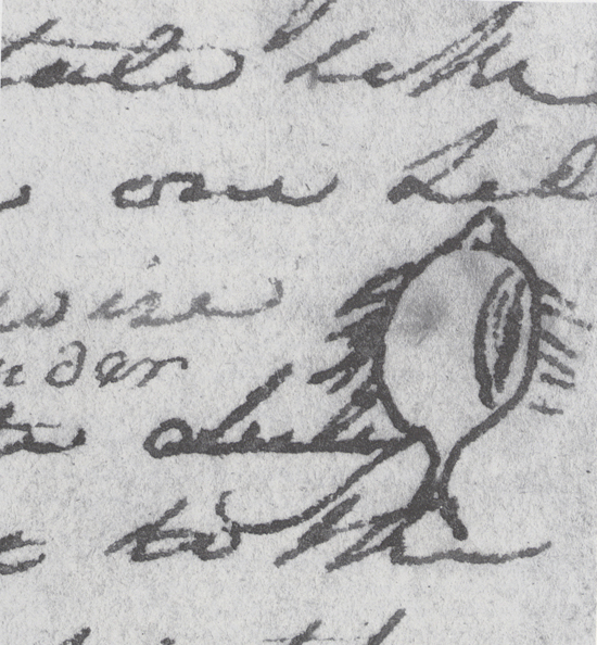
Chin nook river, passed a low bluff of a small hite at 2 miles below which is the remains of huts near which place is also the remains of a whale on the Sand, [12] the countrey low open and Slashey, with elivated lands inter- spersed covered with [NB?: Some] pine & thick under groth This river is 40 yards wide at low tide— here we made a fire and dined on 4 brant and 48 Pliver which was killed by Labiech on the coast as we came on. Rubin Fields Killed a Buzzard [NB?: Vulture] of the large Kind near the meat of the whale we Saw: W. 25 lb. measured from the tips of the wings across 9½ feet, from the point of the Bill to the end of the tail 3 feet 10¼ inches, middle toe 5½ inches, toe nale 1 inch & 3½ lines, wing feather 2½ feet long & 1 inch 5 lines diami- ter tale feathers 14½ inches, and the head is 6½ inches in- cluding the beak. [NB: head in Peale's Mus.] [13] after dineing we crossed the river in an old canoe which I found on the Sand near Som old houses & proceeded on— |
| S. 20° W. | 4 | Miles to a Small rock island in a deep nitch passed a nitch at 2 miles in which there is a dreen from Some ponds back, the land low opposite this nitch a bluff of yellow Clay and Soft Stone from the river to the Comencement of this nitch be- low the Country rises to high hills of about 80 or 90 feet above the water— at 3 miles passed a nitch— this rock Island is Small and at the South of a deep bend in which the nativs in- form us the Ships anchor, and from whence they receive their goods in return for their peltries and Elk Skins &c. this ap- pears to be a very good harber for large Ships. here I found Capt Lewis name on a tree. I also engraved my name & by land the day of the month and year, as also Several of the men. |
| S. 46° E. | 2 | Miles to the inner extremity of
Cape Disapointment
passing a nitch in which there is a Small rock island, a Small Stream falls into this nitch from a pond which is imediately on the Sea Coast passing through a low isthmus. this Cape is an elli- vated 〈Situat〉 Circlier point Covered with thick timber on the iner Side and open grassey exposur next to the Sea and rises with a Steep assent to the hight of about 150 or 160 feet above the leavel of the water 〈from the last mentioned nitch—〉 this cape as also the Shore both on the Bay & Sea coast is a dark brown rock. I crossed the neck of Land low and ½ of a mile wide to the main Ocian, at the foot of a high open hill project- ing into the ocian, and about one mile in Sicumfrance. I as- sended this hill which is covered with high corse grass. de- cended to the N. of it and camped. I picked up a flounder on the beech this evening.— |
| Miles ☞ | 19 |
from Cape Disapointment to a high point of a Mountn. which we shall call [NB: Clarke's Point of View] [14] beares S. 20° W. about 〈40〉 [WC?: 25] miles, point adams is verry low and is Situated within the direction between those two high points of land, the water appears verry Shole from off the mouth of the river for a great distance, and I cannot assertain the direction of the deepst Chanel, the Indians point nearest the opposit Side. the waves appear to brake with tremendious force in every direction quite across a large Sand bar lies within the mouth nearest to point Adams which is nearly covered at high tide. I suped on brant this evening with a little pounded fish. Some rain in the after part of the night. men appear much Satisfied with their trip beholding with estonishment the high waves dashing against the rocks & this emence ocian.
[Ordway]
Monday 18th Nov. 1805. Cloudy. Capt. Clark myself and 10 more of the party [15] Set out in order to go down and see the passiffic ocean. we proceeded on round Hailys bay [16] crossed two Rivers [17] in Sd. bay. one of the party [18] killed a verry large turkey buzzard which had white under its wings, and was nine feet from the points of the wings, and 3 feet 10 Inches in length, and everey way proportined. we proceeded on round high clifts of rocks where we had much trouble to pass.— towards evening we arived at the Cape disapointment on the Sea Shore. went over a bald hill [19] where we had a handsom view of the ocean. we went on a Short distance on the coast and Camped [20] for the night.
[Gass]
Monday 18th. The morning was cloudy. Capt. Clarke and 10 men [21] went down to Cape Disappointment, to get a more full view of the ocean; and 3 went out to hunt. In the course of the day we got some dried salmon and roots from the natives. In the evening our hunters came in with a deer, 2 brants, a squirrel, a hawk, and a flounder, [22] which the tide had thrown on a sand-bar. The Indians still remained with us, and Capt. Lewis got a specimen of their language. Those who live about the seashore and on Rogue's harbour creek, [23] a large creek that comes in on the north side of the bay, call themselves the Chin-ook nation.
[Whitehouse]
Monday Novemr 18th We had a cloudy morning. Captain Clark, 2 Serjeants & eight of our Men [24] set out in Order to go down to Cape disappointment, (the Name of the Cape) in Order to get a satisfactory View of the Ocean &ca.
The Indians came to our Camp, from whom we purchased some dry Salmon. Towards evening our hunters returned to our Camp; they had killed One Deer, 2 brants & a squirrel & also a large fish called Flounder, [25] which they brought with 〈us〉 them to our Camp.— Our officers named this Cape Cape disappointment [26] on account of not finding Vessells there.—

